
Landscape Notes

This is a running collection of notes from the ground. Short updates that document the evolving understanding of Mwatu’s landscape. From slope gradients and soil types to circulation paths and water patterns, these entries reflect the thinking behind how we’re shaping the land with intention. It’s a way to share progress, decisions, and insights as Mwatu grows into a connected, purposeful environment.

Archive

View All

Land Suitability Summary

The different gradients across the land present different opportunities and levels of suitability for development. Riparian land - 20.7% Sections with steep slopes (above 20%) - 28% Sections suitable for development (with less than 20% gradient) - 51.3%  

Circulation

Charting the connection of circulation corridors needs to be directional, functional, experiential, and sustainable. From the central arboretum corridor, hosting a driveway, bike and walking trails, to the river access greenways, the design bias is towards making movement across the land easy to navigate for children, the elderly and disabled.

Hydrology

3 zones in the riparian area present natural points for natural storm water collection. Designing water pans in these zones presents opportunities for both water management opportunities blended with recreational and community experiences. Tracing the natural storm water pathways across the ground also presents the opportunity to craft our storm water management systems in ways…

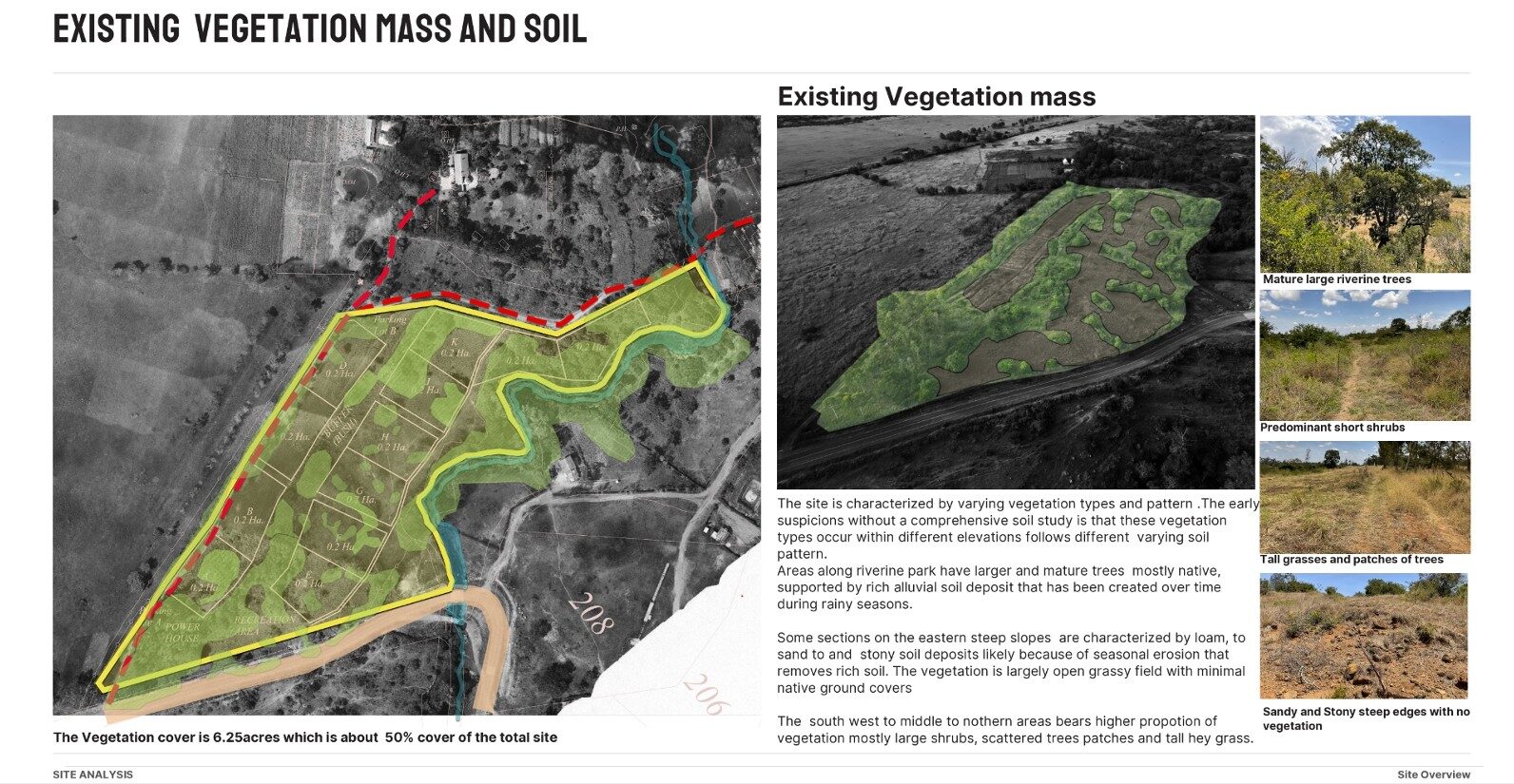
The land is characterized by varying vegetation types and patterns across the different elevations. We have so far cataloged over 130 varieties of plant and tree varieties. From mature, indigenous trees in the riparian zone to the loamy, sandy and stony sections where there has been seasonal erosion, the vegetation cover is spread across approximately…

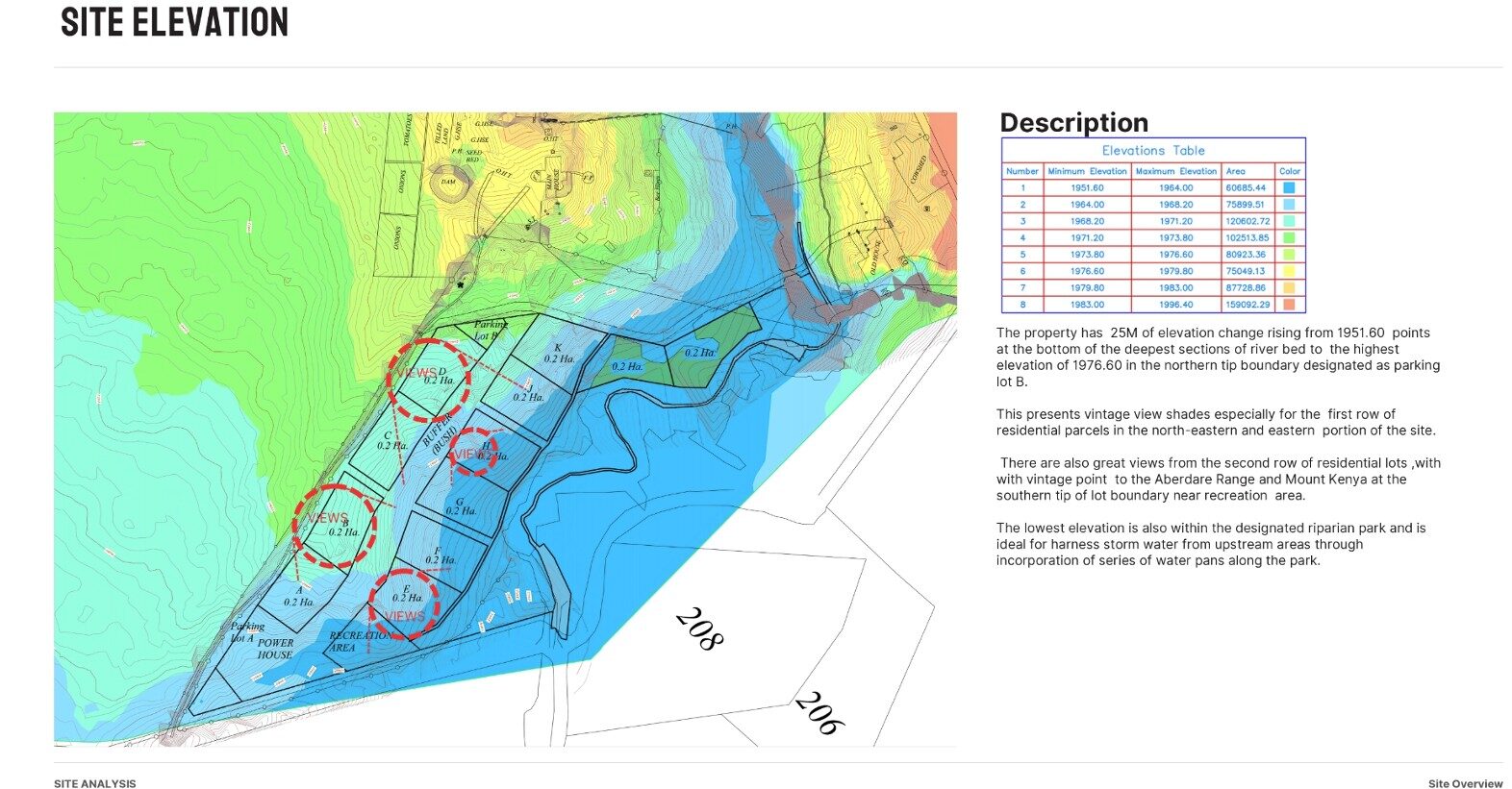
Site Elevation

A balance of vintage views and water harvesting potential between the high and low points of the land. Every portion has its own unique perspective of the panorama with the land as a whole hosting 25 metres of elevation between its deepest and highest points  

Slopes and Vegetation

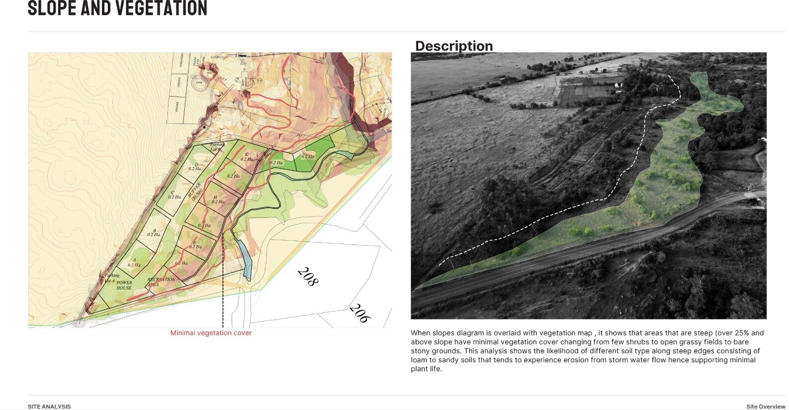
Observing and understanding the relationship between slopes, soil and vegetation. Steeper slopes (above 25% gradient) have minimal vegetation changing from a few shrubs to open grassy fields to bare stony ground. How can we reshape the landscape to soak and harvest more water and support regenerative growth of a wide variety of vegetation?

Slope Analysis – 4

The provision for an 18metre wide x 350 metre long arboretum space between the portions of land means everyone gets to enjoy this central feature. the 7%gradient in the slope of this central spine, leds itself to themed gardens, circulation spaces and storm water management elements.  

Slope Analysis – 3

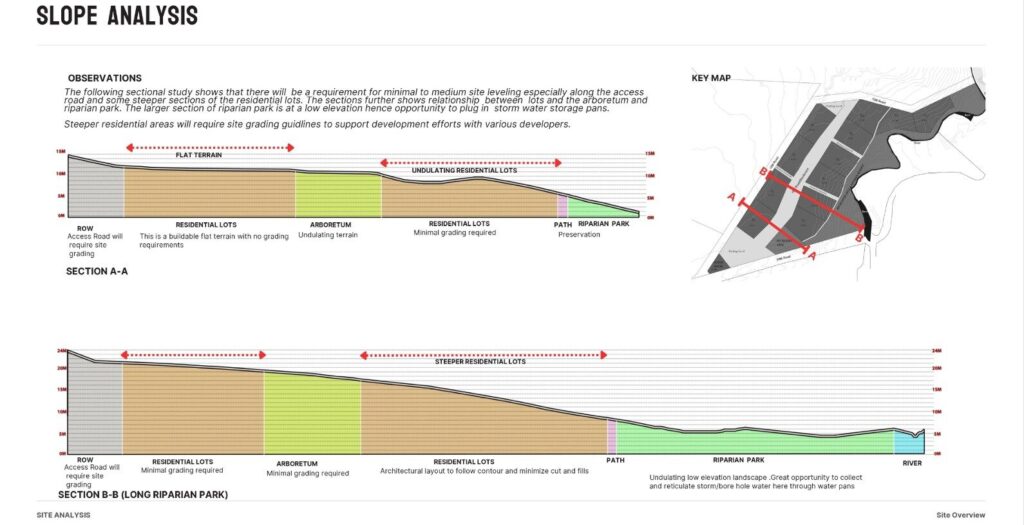
Understanding the different requirements for site levelling across the different zones of the slope

Slope Analysis – 2

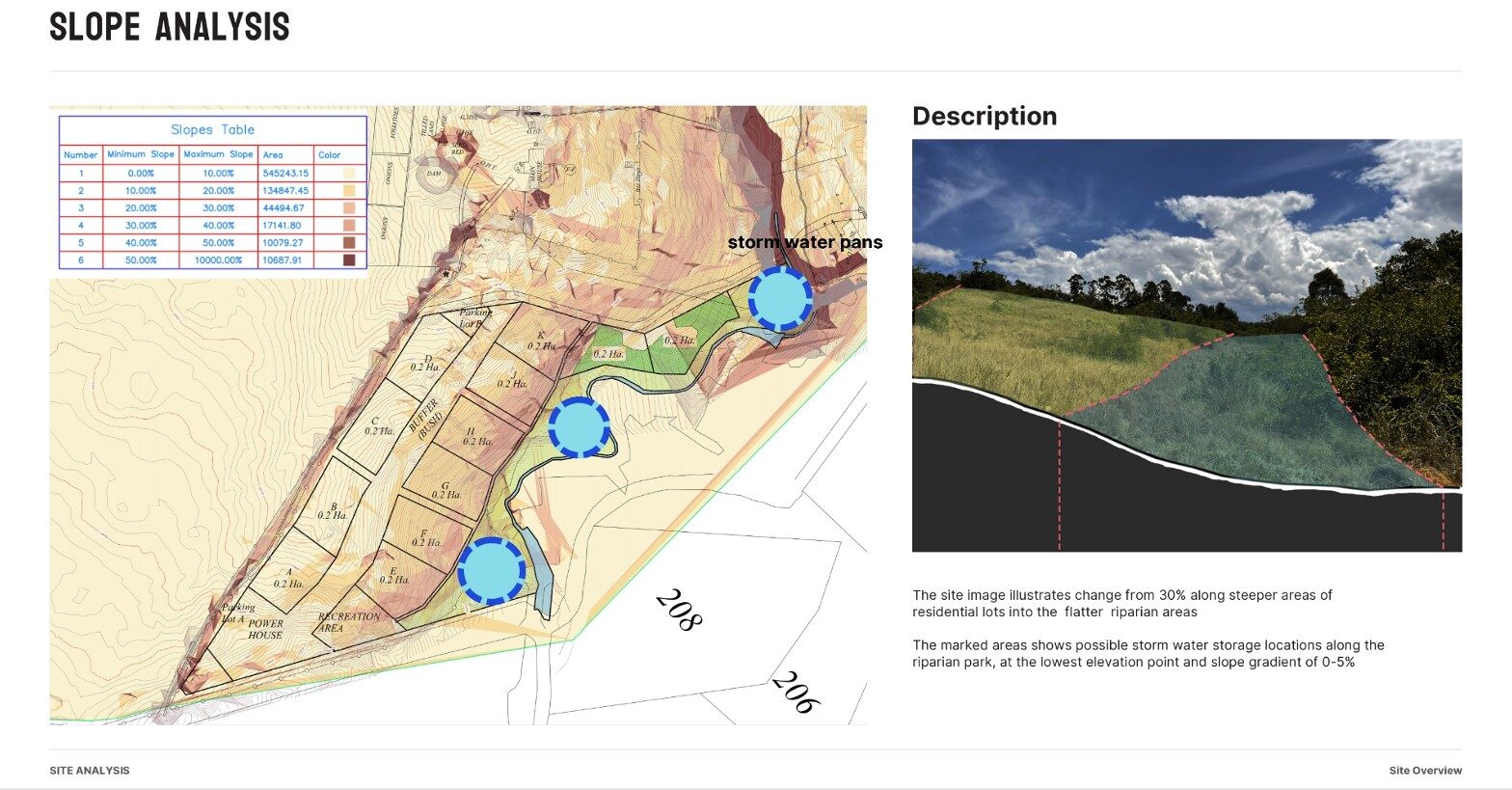
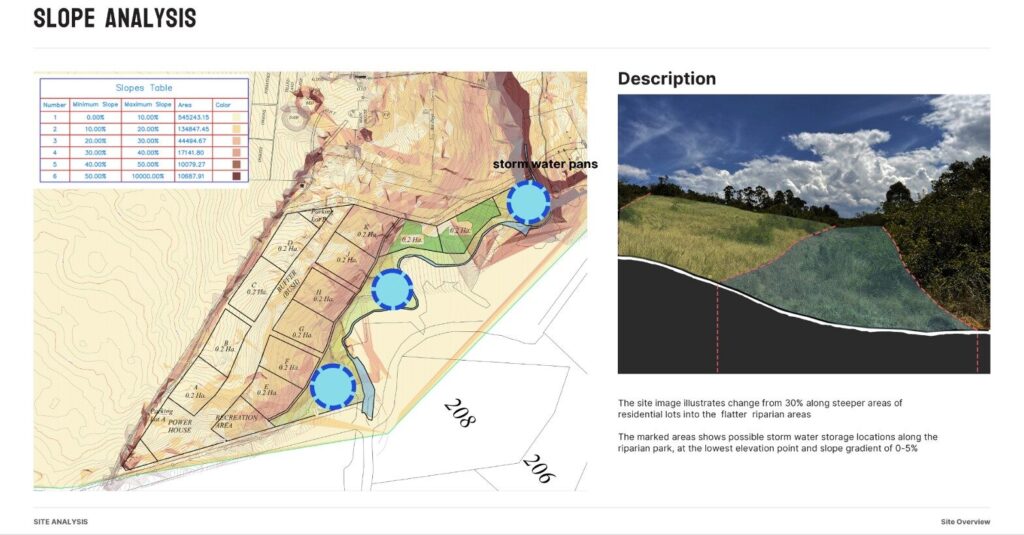
Understanding the storm water management potential of the different gradients of the slopes in the land. We can see how to enhance the land's ability to soak in and harvest water, as well as understand the best storage sites.

Slope Analysis – 1

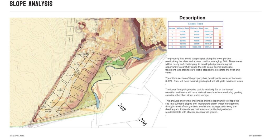
This analysis shows the challenges and opportunities to shape the site into buildable slopes and incorporate storm water management through a series of rain gardens, swales and storage pans along the riparian (park) zone.  

Site Analysis – Pics

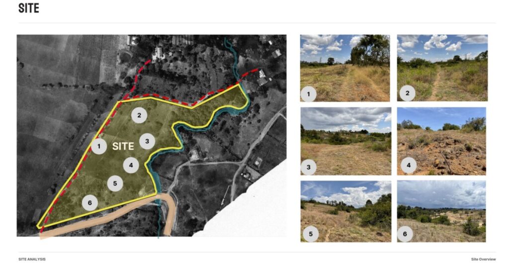
Observing and understanding different features about the site - this was during a bit of a dry season, and among the things that were clearly visible were erosion channels - which also signified the natural paths being carved by water across the land. Being able to see the land across droughts and rainy seasons guides…

Site Analysis – Location

This isn’t remote. It’s perfectly placed. A weekend away becomes a way of life. A morning walk turns into panorama's and birdwatching. A land investment becomes part of a living landscape. Each half-acre at KES 7.5M connects you to more than the plot. It connects you to a rhythm of walking, cycling, stillness, and return.…

1. Land Is a Living System

We develop with the land — not on top of it. Every feature is designed to align with the rhythms of soil, water, trees, and memory.          

The Nature of Mwatu – Culture Is the Real Yield

We don’t just sell plots. We growing a community with participation, presence, and place. This is where food, play, and people meet to cultivate long-term value.

12 Acres. Not for Subdivision.

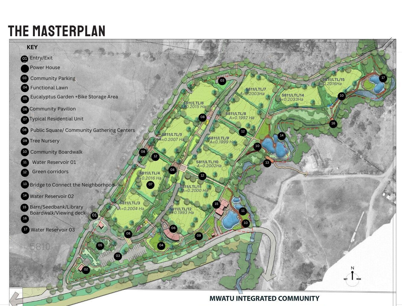
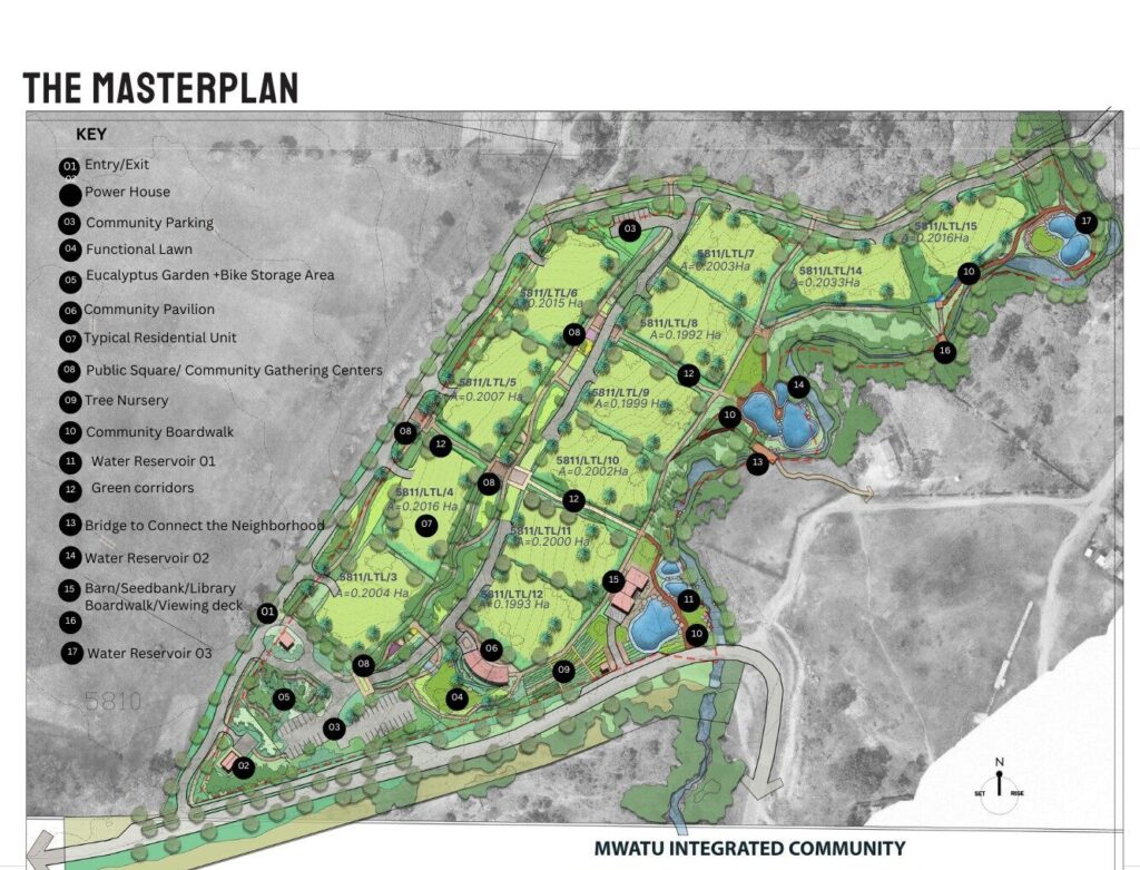
Mwatu is being developed as an integrated landscape — not broken into plots, but woven into purpose. Playgrounds, gardens, forest walks, and public fields are the building blocks of our economy.

Interested in Mwatu? Let’s Talk.

Let’s Grow Something Meaningful Together

Mwatu is more than land; it's a thoughtfully designed neighborhood grounded in ecology, community, and care. If this vision speaks to you, we’d love to share more.

  • Steward-led living

  • Intentional community

  • Ecology-first design

Quick Bits

Quick Bits

12 Acres. Not for Subdivision.

Mwatu is being developed as an integrated landscape — not broken into plots, but woven into purpose.
Playgrounds, gardens, forest walks, and public fields are the building blocks of our economy.

Quick Bits

Quick Bits

Land Suitability Summary

The different gradients across the land present different opportunities and levels of suitability for development.

Riparian land – 20.7%

Sections with steep slopes (above 20%) – 28%

Sections suitable for development (with less than 20% gradient) – 51.3%


Quick Bits

Quick Bits

Circulation

Charting the connection of circulation corridors needs to be directional, functional, experiential, and sustainable. From the central arboretum corridor, hosting a driveway, bike and walking trails, to the river access greenways, the design bias is towards making movement across the land easy to navigate for children, the elderly and disabled.

Quick Bits

Quick Bits

Hydrology

3 zones in the riparian area present natural points for natural storm water collection. Designing water pans in these zones presents opportunities for both water management opportunities blended with recreational and community experiences.

Tracing the natural storm water pathways across the ground also presents the opportunity to craft our storm water management systems in ways that work with the land

Quick Bits

Quick Bits

The land is characterized by varying vegetation types and patterns across the different elevations. We have so far cataloged over 130 varieties of plant and tree varieties.

From mature, indigenous trees in the riparian zone to the loamy, sandy and stony sections where there has been seasonal erosion, the vegetation cover is spread across approximately 6.25 acres or 50% of the 12 acre site

Quick Bits

Quick Bits

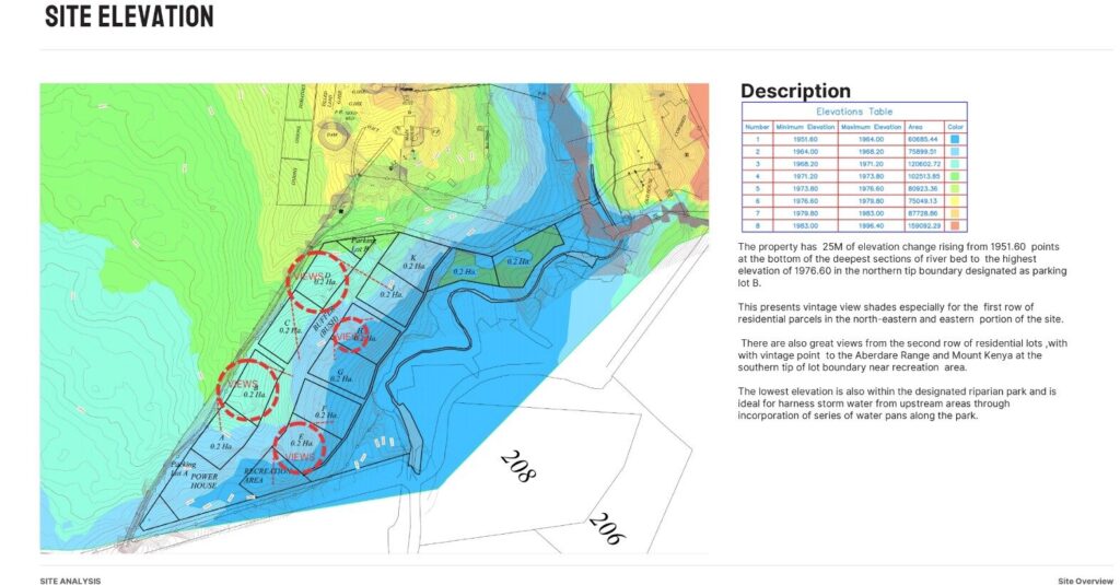
Site Elevation

A balance of vintage views and water harvesting potential between the high and low points of the land. Every portion has its own unique perspective of the panorama with the land as a whole hosting 25 metres of elevation between its deepest and highest points


Quick Bits

Quick Bits

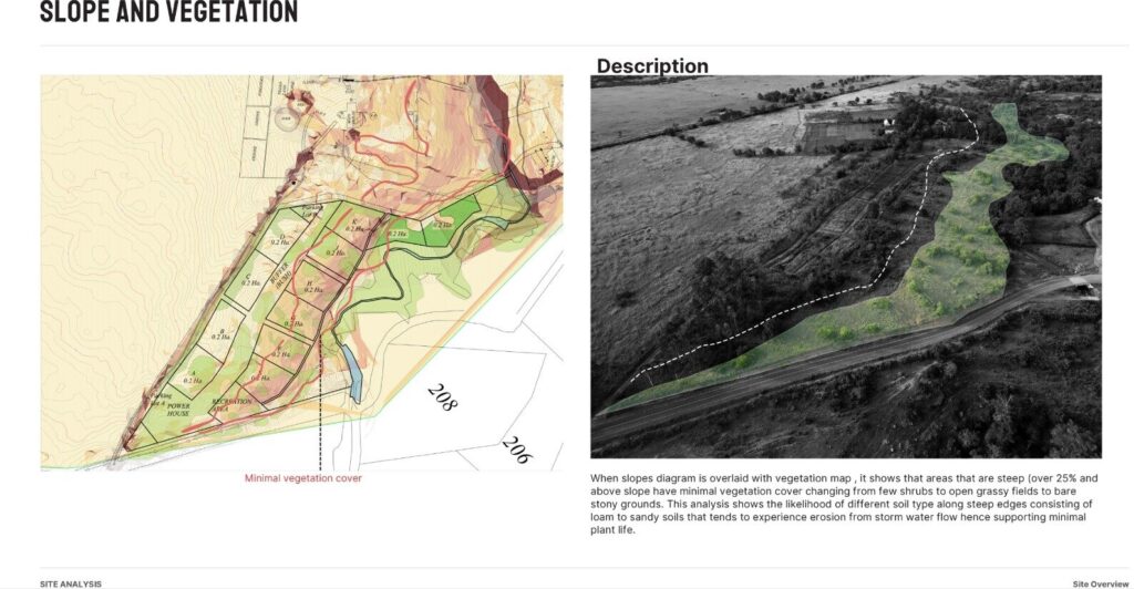
Slopes and Vegetation

Observing and understanding the relationship between slopes, soil and vegetation. Steeper slopes (above 25% gradient) have minimal vegetation changing from a few shrubs to open grassy fields to bare stony ground. How can we reshape the landscape to soak and harvest more water and support regenerative growth of a wide variety of vegetation?
Quick Bits

Quick Bits

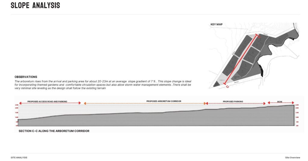
Slope Analysis – 4

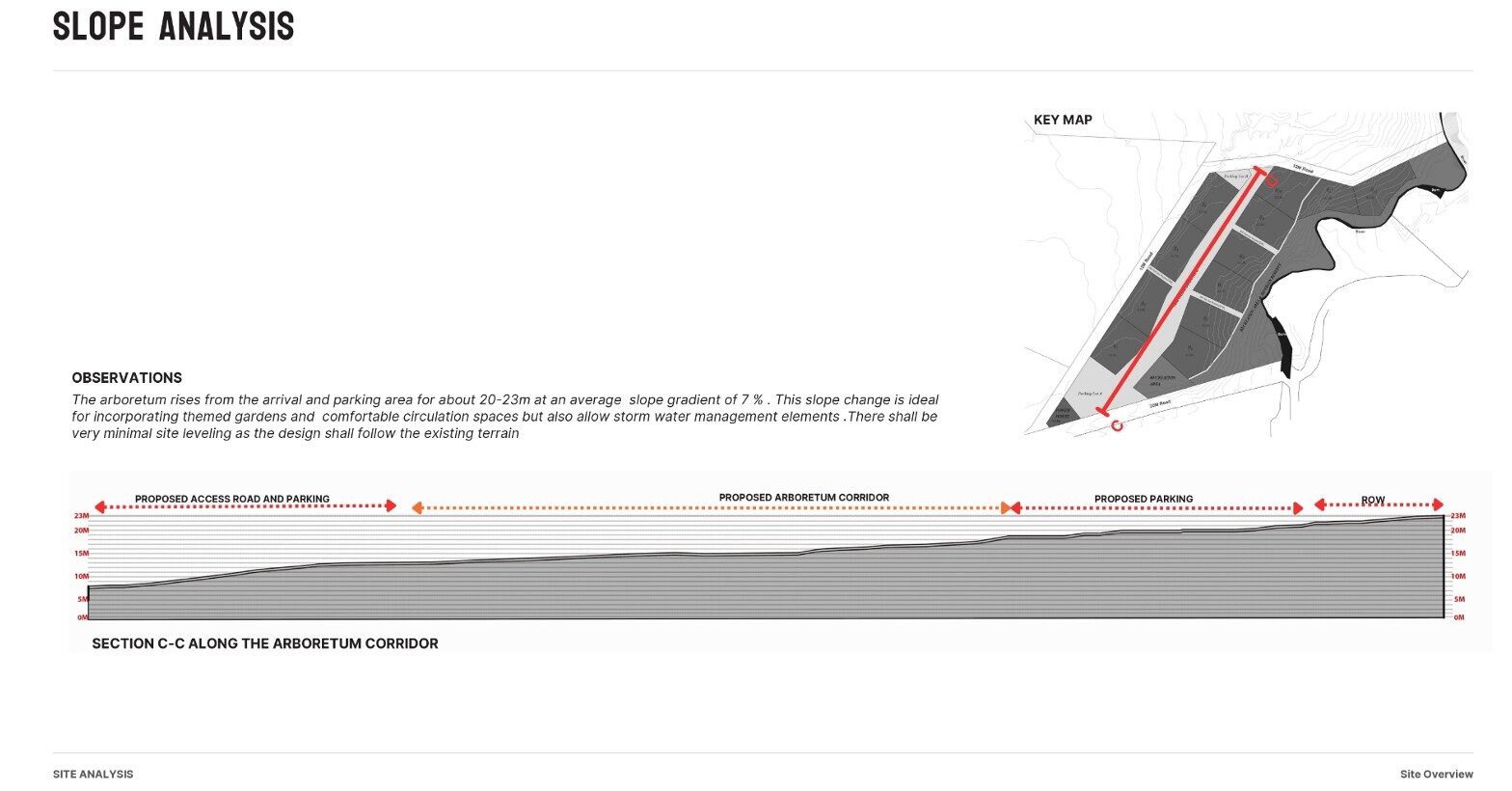
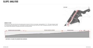
The provision for an 18metre wide x 350 metre long arboretum space between the portions of land means everyone gets to enjoy this central feature. the 7%gradient in the slope of this central spine, leds itself to themed gardens, circulation spaces and storm water management elements.


Quick Bits

Quick Bits

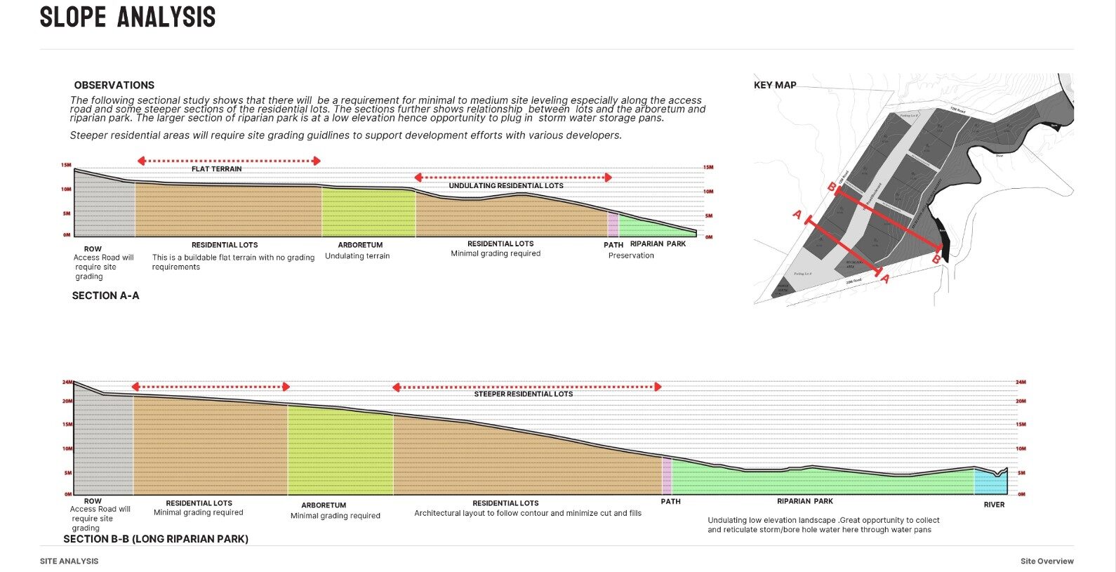
Slope Analysis – 3

Understanding the different requirements for site levelling across the different zones of the slope

Quick Bits

Quick Bits

Slope Analysis – 2

Understanding the storm water management potential of the different gradients of the slopes in the land. We can see how to enhance the land’s ability to soak in and harvest water, as well as understand the best storage sites.

Quick Bits

Quick Bits

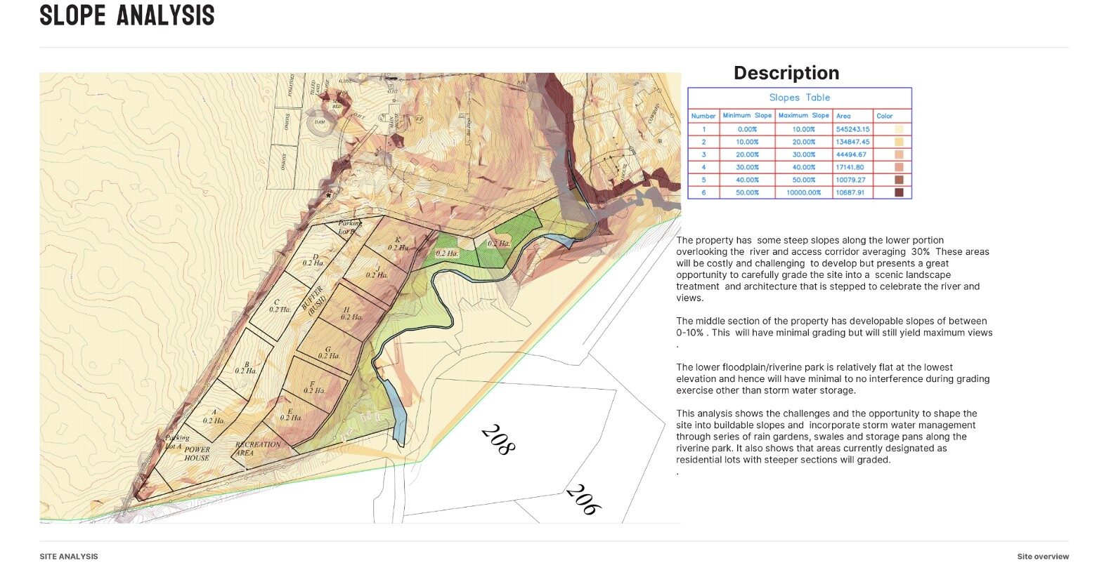
Slope Analysis – 1

This analysis shows the challenges and opportunities to shape the site into buildable slopes and incorporate storm water management through a series of rain gardens, swales and storage pans along the riparian (park) zone.


Quick Bits

Quick Bits

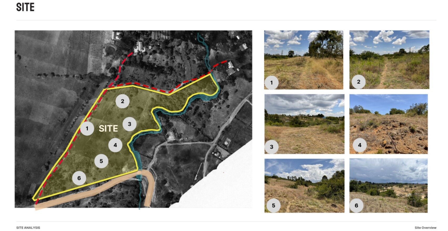
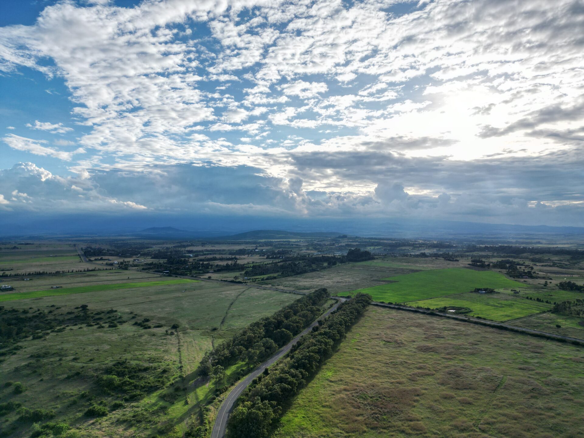
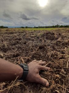
Site Analysis – Pics

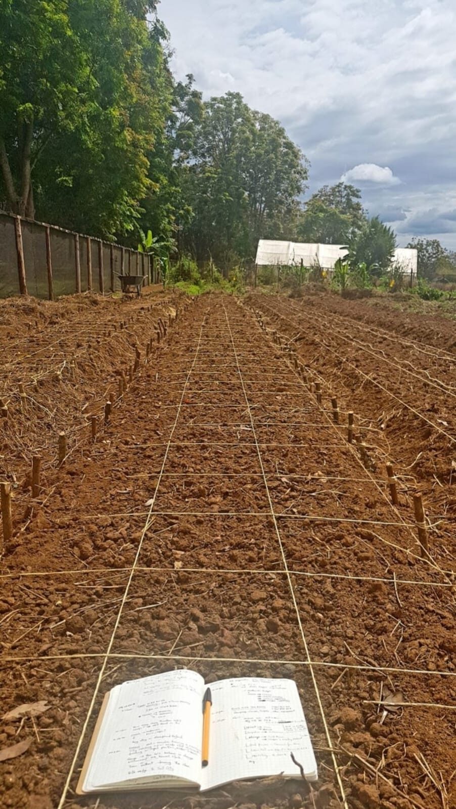
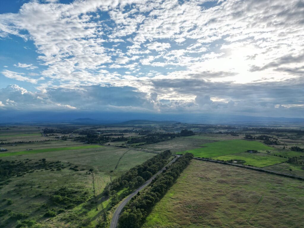
Observing and understanding different features about the site – this was during a bit of a dry season, and among the things that were clearly visible were erosion channels – which also signified the natural paths being carved by water across the land. Being able to see the land across droughts and rainy seasons guides our understanding of how to live with the land.

Quick Bits

Quick Bits

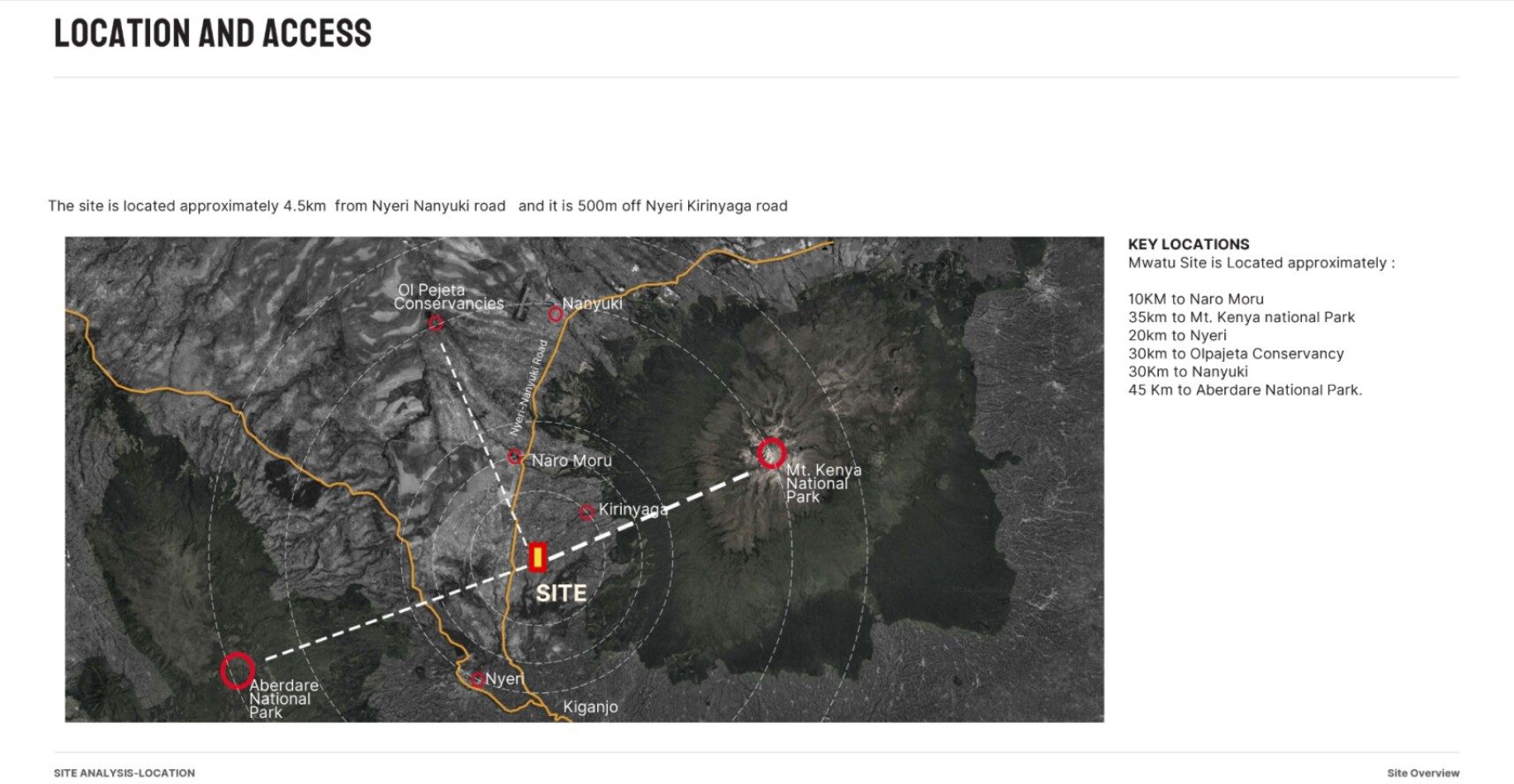
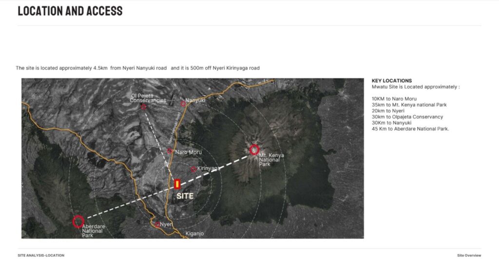
Site Analysis – Location

This isn’t remote. It’s perfectly placed.

A weekend away becomes a way of life.
A morning walk turns into panorama’s and birdwatching.
A land investment becomes part of a living landscape.

Each half-acre at KES 7.5M connects you to more than the plot. It connects you to a rhythm of walking, cycling, stillness, and return.

Come walk the land. You’re closer than you think.

Quick Bits

Quick Bits

1. Land Is a Living System

We develop with the land — not on top of it.
Every feature is designed to align with the rhythms of soil, water, trees, and memory.


Quick Bits

Quick Bits

The Nature of Mwatu – Culture Is the Real Yield

We don’t just sell plots. We growing a community with participation, presence, and place.
This is where food, play, and people meet to cultivate long-term value.

Quick Bits

Quick Bits

12 Acres. Not for Subdivision.

Mwatu is being developed as an integrated landscape — not broken into plots, but woven into purpose.
Playgrounds, gardens, forest walks, and public fields are the building blocks of our economy.

Quick Bits

Quick Bits

Landscape Notes